PROTOTYPE LESSON PLANS (for 6th grade)
These prototype lesson plans were developed with the intent of providing a resource for Connecticut Educators at the middle school level to explore the theme of the Human-Environment Interaction through the use of remote sensing imagery.
– Lesson I provides an overview of remote sensing and allows an educator to walk through the process of remote sensing with the students to help them learn basic image interpretation skills that will allow them to better understand imagery.
– Lesson II provides an opportunity for educators and students to think about the size of the earth and human populations and then explore selected case studies of human-environment interactions from throughout the world (currently only South America has provided case studies).
NOTICE: Both of these lessons are still under development and currently provided as DRAFTS (in a PDF format) with the ultimate intent to make them web-based interactive pages.
Funding was provided through a mini-grant by AmericaView.
 |
 |
ESRI CHANGEMATTERS VIEWER
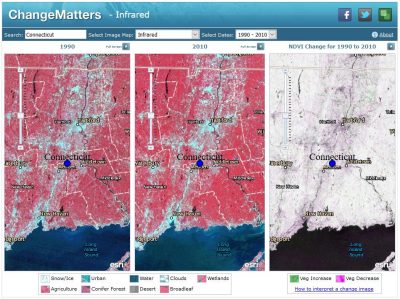
ESRI’s free Web application, ChangeMatters, allows teachers and students to rapidly view Landsat* imagery anywhere in the world (including around your school!), both multi-spectrally and multi-temporally, and to map change over time. The application’s functionality includes the ability for users to rapidly:
- Search for Landsat GLS imagery anywhere in the world,
- View Landsat GLS imagery in up to 11 different band/ product variations and compare the imagery to base maps,
- View two dates of imagery and a change image side by side with linked pan and zoom. The change image is a composite of NDVIs for the two dates, and
- Interactively map change between two dates of imagery.
*Landsat represents the world’s longest continuously acquired collection of space-based moderate-resolution land remote sensing data.
Summary adapted from “Change Matters” by Kass Green, Photogrammetric Engineering & Remote Sensing, April 2011.
GOOGLE TIMELAPSE IMAGERY
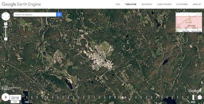
Timelapse is a global, zoomable video that allows you to explore the Earth and see how it has changed over time from 1984 until the present. It is made from cloud-free annual mosaics, mostly from Landsat satellite images, which are made interactively explorable by Carnegie Mellon University CREATE Lab’s Time Machine library, a technology for creating and viewing zoomable and pannable timelapses over space and time.
REMOTE SENSING IMAGERY GAME
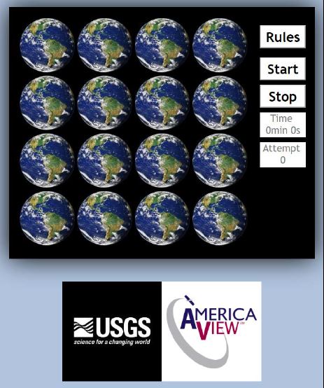 This interactive “memory game” will allow students will explore satellite images from various locations throughout the world, identify their visible physical characteristics, detect land cover change over a certain time period, train their memory to quickly recognize patterns and stimulate the understanding of basic concepts about digital geospatial data such as resolution and image interpretation. Click on the image above to go to the game page.