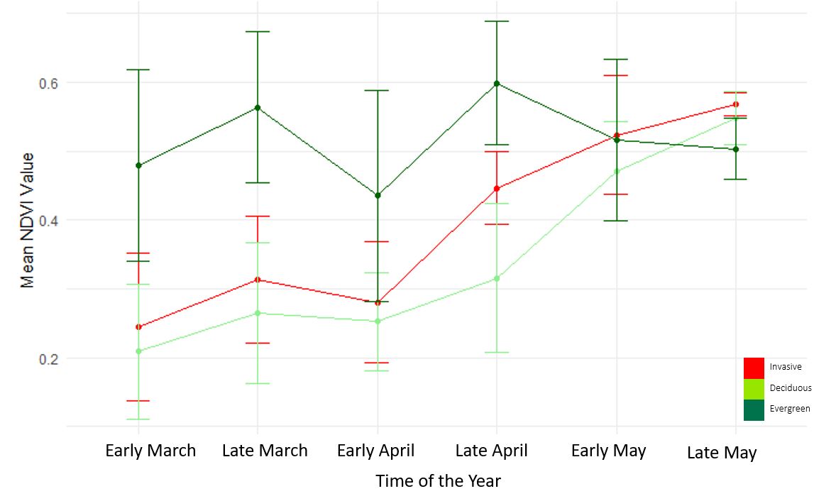
We studied the response of seven vegetation indices, corresponding to 36 study sites, according to the occurrence of three vegetation types during the period when invasive shrubs show the extended plant leaf phenology. Training data was built from available scenes with less than 15% cloud coverage from early March to late May. The data consists of Sentinel-2 image scene (acquired from 2018-2023 to build a sufficient training data set). The analysis was done with the objectives of identifying the time of early spring and the indices that would be most important in accurately determining the probability of a pixel being an invasive understory pixel due to the spread of Berberis thunbergii or/and Rosa multiflora infestations in Connecticut forests.
According to results of Multinomial Logistic Regression (MLR), we predicted the probability of a pixel being an invasive, evergreen or completely deciduous plant. MLR variable selection was done as a pre-processing step. NDRE, NDVI, NDMI indices for late March images and MSAVI2, NDMI, NDVI for late April images were picked up as the best variables to predict the probability of Japanese Barberry or/and Multiflora Rose infestations.
 |
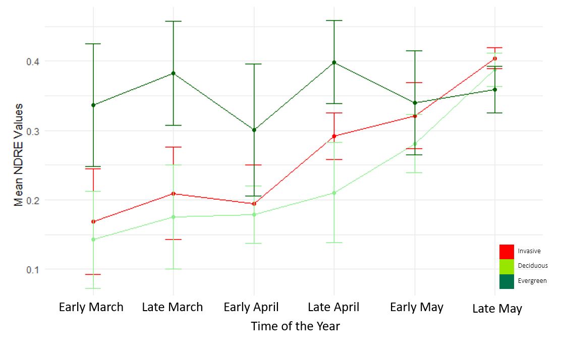 |
| NDVI response for each vegetation class during early spring time | NDRE response for each vegetation class during early spring time |
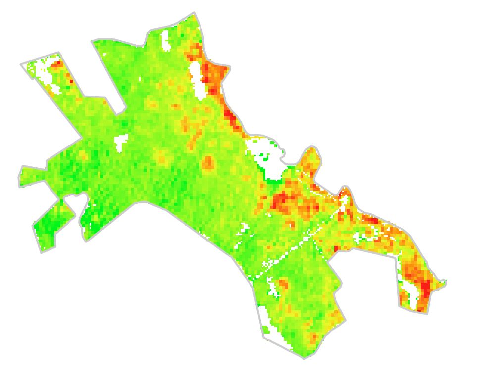
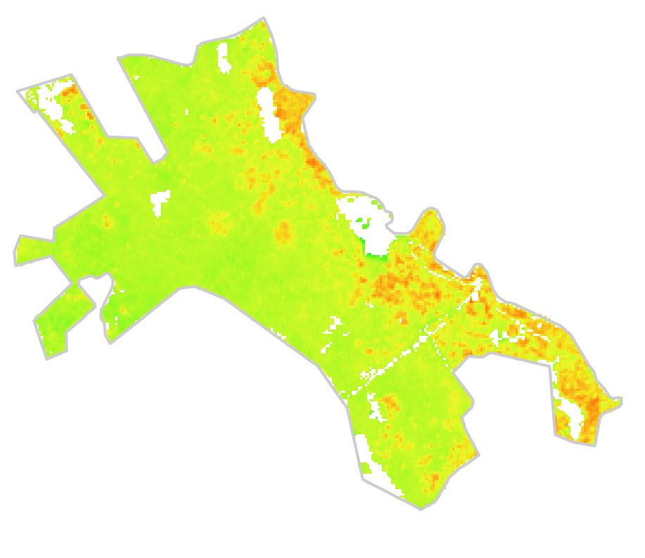
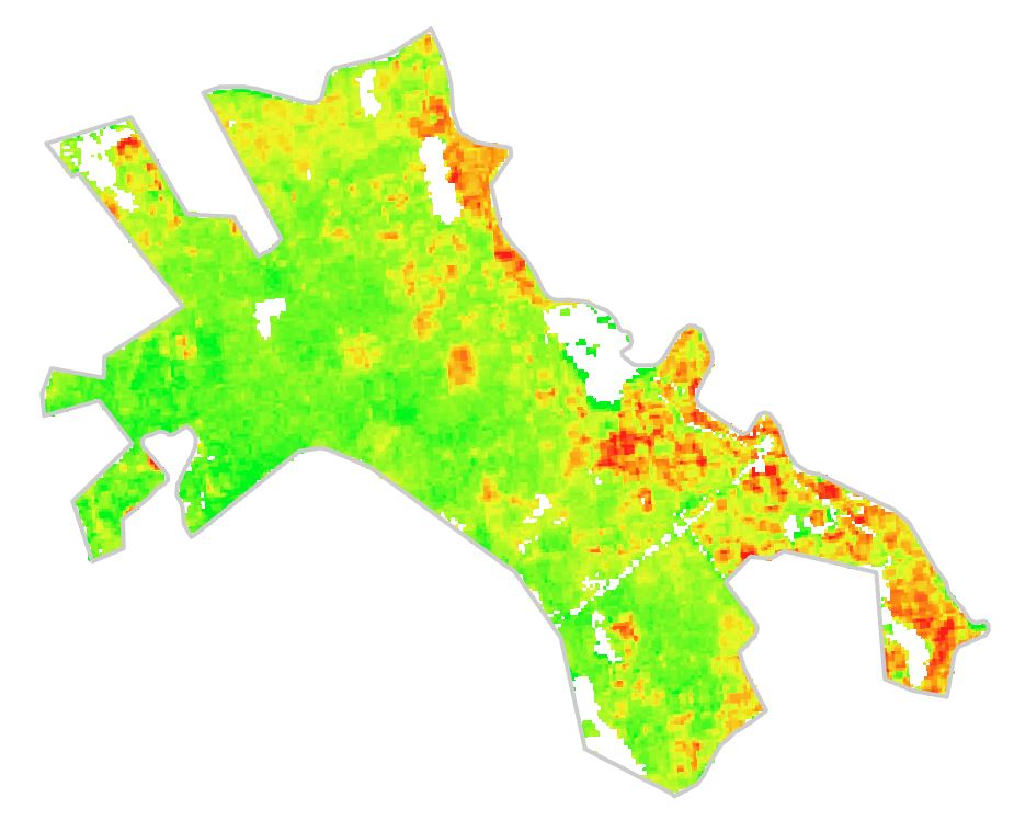
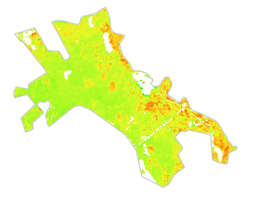
The below rasters illustrate the responses of selected vegetation indices over a selected period of time around the forest pixels of UConn Forest, Horsebarn Hill, Storrs (Derived from Sentinel-2 BOA bands, Early spring 2023)
 |
 |
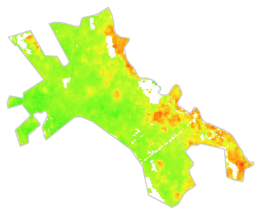 |
| NDRE Late March 2023 | NDVI Late March 2023 | NDMI Late March 2023 |
 |
 |
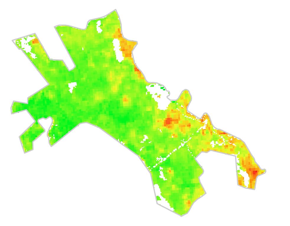 |
| MSAVI2 Late April 2023 | NDVI Late April 2023 | NDMI Late April 2023 |
Invasive pixels were identified using new Sentinel-2 scenes to determine the pixels with a high risk of being infested by invasive shrubs as mentioned above. Comparing NDMI of late March and late April shows the increasing water stress of the infested areas. The change of NDMI varies according to the moisture stress of the vegetation that is impacted by the stability of invasive shrub growth.
 |
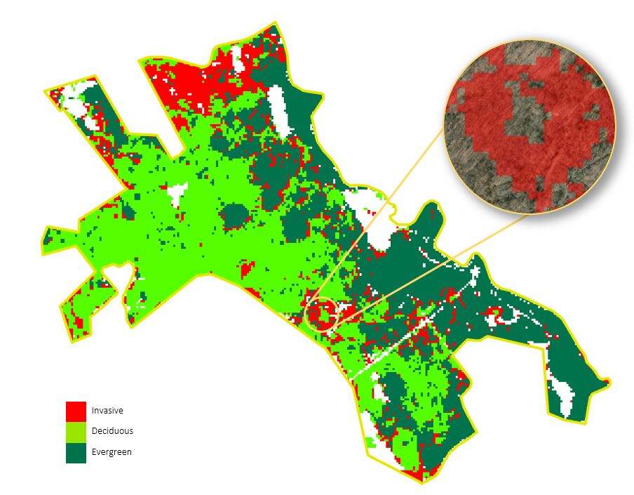 |
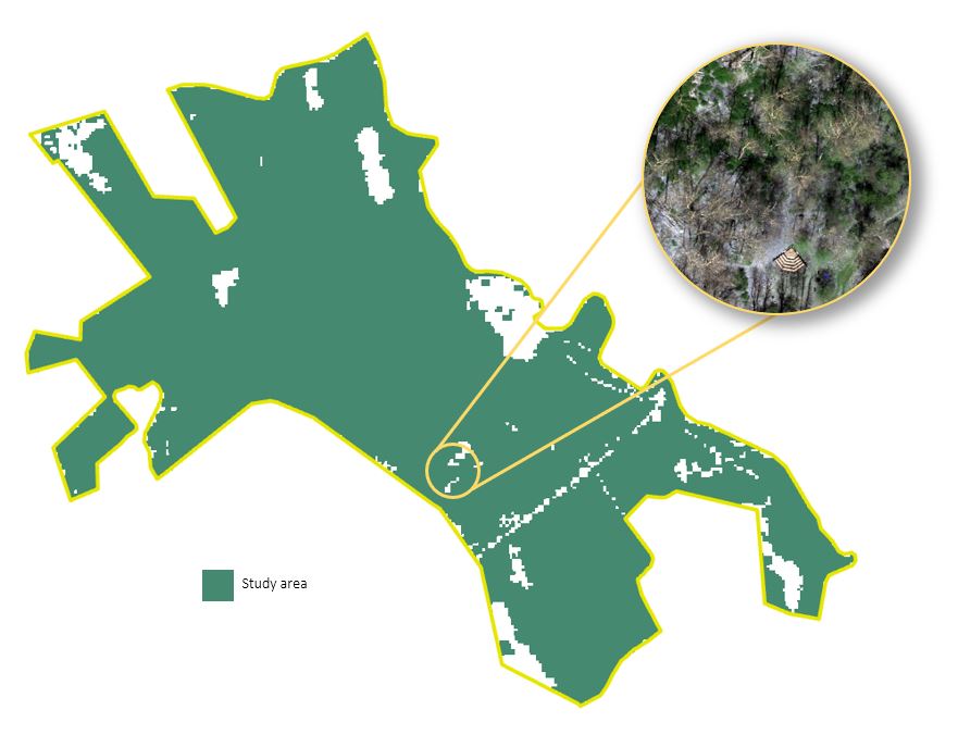
| Forest Pixels around UConn Forest, Storrs, CT (Early spring 2023) and presence of understory shrub infestations | Probability pixels of Three Focal Vegetation Types around UConn Forest, Storrs, CT (Early spring 2023) |
The classification maps can be further improved by more field validation, advanced supervised classification techniques and using machine learning approaches like Random Forest or Support Vector Machine.
********************************************
For information, image data, and other geospatial data related to Connecticut, we recommend you visit the following websites:
– Connecticut Environmental Conditions Online (CTECO)
– Map and Geographic Information Center (MAGIC)
– Connecticut Dept. of Energy and Environmental Protection (DEEP)
– Center for Landuse Education and Research (CLEAR)
– Connecticut State Data Center
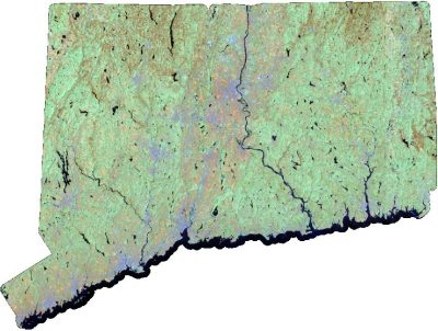
Connecticut Statewide Landsat 8 Mosaics in TIF format (click image to download ZIP file, approx 220 Mb)
 |
 |
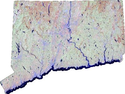 |
| Landsat 8, June 2016 | Landsat 8, April 2016 | Landsat 8, 2014 |
 |
||
| Landsat 5, April 2003 |